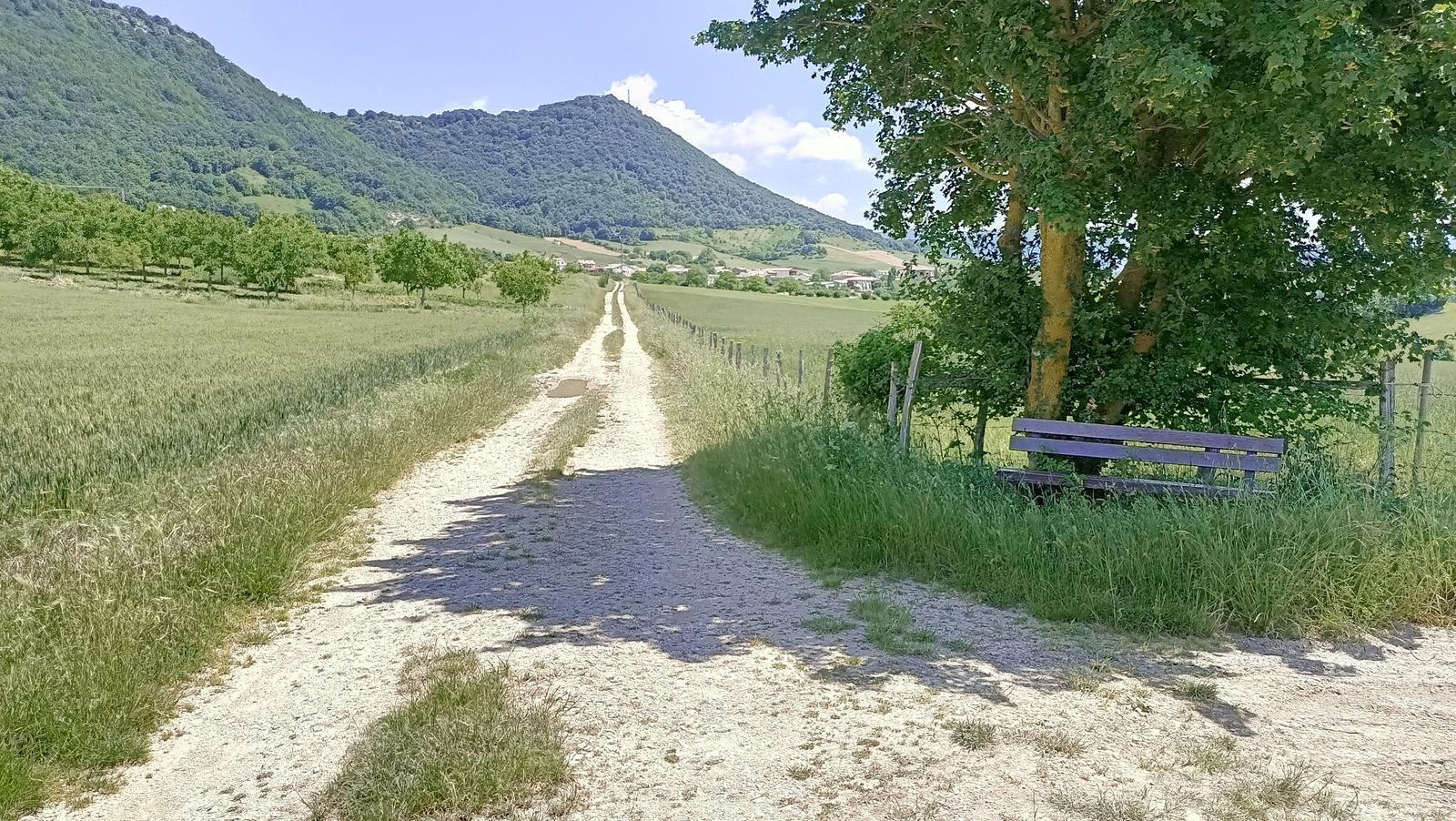
This route is a must if you visit this area with a gravel bike. The Sierra de Urbasa and the Améscoas Valley are places of great beauty but it is important to know the terrain as not all roads are suitable for this type of bicycles. In this route we will ascend Urbasa through a new and hard first part before reaching the conventional ascent by road. We will enjoy the views from the Balcón de Ubaba (also called Pilatos), cross the lush forests of the highlands, including the Alava area of Entzia, and we will finish in the Améscoas, traveling along paths surrounded by mountains.
Route 5: ARTAZA CAMPING
URBASA AND AMESCOAS
Type: GRAVEL
TECHNICAL DATA SHEET
Type: GRAVEL
Distance: 63.4 km.
Accumulated positive elevation gain (according to IBP index): 1026 m.
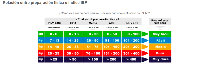
Difficulty (IBP index): 74
DIFFICULTY
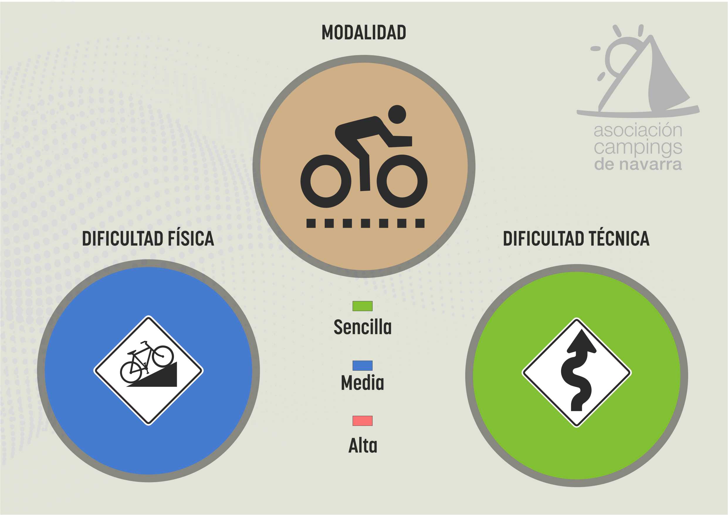
Physical difficulty: MEDIUM
To define the physical difficulty of the routes we have used the IBP index.
IBP index is an automatic rating system that scores the physical difficulty of a route ridden on a mountain bike, road bike or gravel bike. This index is very useful to know the degree of physical difficulty of different routes by comparing them with each other.
It is important not to confuse the degree of physical difficulty of a route with the effort it will take to complete it: an IBP index of 60 will be a very hard route for an uninitiated person, normal for someone with average preparation and very easy for a professional.
In our case, we have taken as a reference a normal physical preparation to assess the physical difficulty of the routes.
Technical difficulty: EASY
For this section there is no mathematical formula that gives us a number, so the assessment is based on knowledge gained from experience.
We have defined the technical difficulty in 3 levels:
– Green color: simple. There is no notable technical difficulty on the route.
– Blue color: medium. We can find areas that present some technical difficulties. In the case of gravel routes, these will be areas with steep uphill or downhill slopes on non-compacted soil, sections of trail or soil in poor condition. In the case of MTB routes, they may be uphill or downhill sections of trail with some complicated passages, due to the state of the terrain or because they are natural trails with a very damaged floor. In both cases, these sections represent a small percentage of the total length of the route.
– Red color: difficult. In both gravel and MTB we find complicated areas such as those defined in the blue color, but with greater frequency and intensity.
On road routes the technical difficulty will always be green, but if the ground is wet or there are ice slabs present, the situation will change completely.
MAP
RECOMMENDATIONS
- The Navarre Campsites Association does not guarantee the maintenance of the routes, so it is possible to encounter obstacles on the routes. However, if this should happen, we would appreciate it if visitors would let us know so that we can take this into account for the future passage of other people.
- It is highly recommended to carry the tracks in the GPS. In some remote areas it is easy to become disoriented.
- It is essential to carry plenty of water for all routes, especially in summer.
- The use of helmets is mandatory.
- Practice low-impact driving to avoid erosion.
- If you are going out unaccompanied, leave notice of the route you are going to take.
- The trails are shared with hikers and horseback riders. Always yield the right of way, these people have priority.
- If you find a livestock closure, leave it as you found it after your passage.
- Facilitates the passage of livestock on all roads.
- Avoid leaving the marked road and accessing private properties.
- Respect the environment and do not leave waste.
- Avoid shouting and disturbing wildlife.
- If you see a hunting sign, turn around and choose another road.
- Respect traffic regulations.
- Be respectful of people on village crossings.
And enjoy the routes of our campsites in Navarra!


